


Boston Ward 2 Precinct 1, Suffolk County, Massachusetts
About
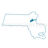
Outline

Summary
| Unique Area Identifier | 595488 |
| Name | Boston Ward 2 Precinct 1 |
| County | Suffolk County |
| State | Massachusetts |
| Area (square miles) | 0.29 |
| Land Area (square miles) | 0.26 |
| Water Area (square miles) | 0.03 |
| % of Land Area | 89.56 |
| % of Water Area | 10.44 |
| Latitude of the Internal Point | 42.37308080 |
| Longtitude of the Internal Point | -71.06530150 |
Maps


Graphs
Select a template below for downloading or customizing gragh for Boston Ward 2 Precinct 1, Suffolk County, Massachusetts


Neighbors
Neighoring Voting District (by Name) Neighboring Voting District on the Map
- Boston Ward 2 Precinct 2, Suffolk County, MA
- Boston Ward 2 Precinct 3, Suffolk County, MA
- Boston Ward 2 Precinct 5, Suffolk County, MA
- Boston Ward 2 Precinct 6, Suffolk County, MA
- Boston Ward 2 Precinct 7, Suffolk County, MA
- Boston Ward 3 Precinct 2, Suffolk County, MA
- Boston Ward 3 Precinct 5, Suffolk County, MA
- Cambridge Ward 1 Precinct 1, Middlesex County, MA
- Somerville Ward 1 Precinct 1, Middlesex County, MA
Top 10 Neighboring County Subdivision (by Population) Neighboring County Subdivision on the Map
- Boston city, Suffolk County, MA (617,594)
- Cambridge city, Middlesex County, MA (105,162)
- Somerville city, Middlesex County, MA (75,754)
Top 10 Neighboring Place (by Population) Neighboring Place on the Map
Top 10 Neighboring Unified School District (by Population) Neighboring Unified School District on the Map
- Boston School District, MA (617,594)
- Cambridge School District, MA (105,162)
- Somerville School District, MA (75,754)
Top 10 Neighboring State Legislative District Lower Chamber (by Population) Neighboring State Legislative District Lower Chamber on the Map
- Second Suffolk District, MA (42,436)
- Twenty-Sixth Middlesex District, MA (41,109)
- Eighth Suffolk District, MA (39,543)
- State House Districts not defined, MA (0)
Top 10 Neighboring State Legislative District Upper Chamber (by Population) Neighboring State Legislative District Upper Chamber on the Map
- First Suffolk & Middlesex District, MA (174,180)
- Middlesex, Suffolk & Essex District, MA (168,830)
- State Senate Districts not defined, MA (0)
Top 10 Neighboring 111th Congressional District (by Population) Neighboring 111th Congressional District on the Map
Top 10 Neighboring Census Tract (by Population) Neighboring Census Tract on the Map
- Census Tract 408.01, Suffolk County, MA (3,900)
- Census Tract 403, Suffolk County, MA (3,882)
- Census Tract 203.03, Suffolk County, MA (3,400)
- Census Tract 305, Suffolk County, MA (2,538)
- Census Tract 406, Suffolk County, MA (2,444)
- Census Tract 404.01, Suffolk County, MA (2,439)
- Census Tract 3515, Middlesex County, MA (2,310)
- Census Tract 401, Suffolk County, MA (2,168)
- Census Tract 3521.01, Middlesex County, MA (1,654)
- Census Tract 402, Suffolk County, MA (1,606)